Fall Storm Chase in Iowa
It’s been a bit of a thunderstorm drought this summer and fall here in NYC, and I've been busting my ass for weeks on school commitments and Gravesend Inn stuff. So, when I saw a tornado outbreak forecast in Iowa for a Friday when I had the day off (after working 13 days straight), I figured I should go for it, despite Iowa’s reputation for difficult and frustrating storm chasing. The early models put the severe threat across most of Iowa and up into southern Minnesota, so I booked my flights in/out of Chicago, which is within reasonable striking distance and also has a lot of flight flexibility (these days there are very few direct flights into many of the cities in the plains). I’m going to post my photo highlights here, and if you’re interested in the chase details I've got them below (for me if no one else). But in the end, while I missed all the tornadoes (basically, I went south and the storms stayed north), it was still a good trip, despite a nasty cold that came on literally hours after I bought my non-refundable plane tickets. For me there’s nothing more engaging than picking chase targets, safely navigating around severe or tornado-warned storms, all the while planning escape routes and trying to frame a shot and get it in focus, sometimes in a scene only illuminated by lightning. Storm chasing is one of the rare times I get in that hyper-engaged state of “flow”, and those times make all the hassles worth it. And despite the danger and the attendant tragic impact on people’s lives, I find the storms themselves to be quite a beautiful indication of nature’s power.
My first severe storm of the day near Adel:


From near Bartlett, a severe-warned storm approaching from Nebraska:


Near Glenwood:


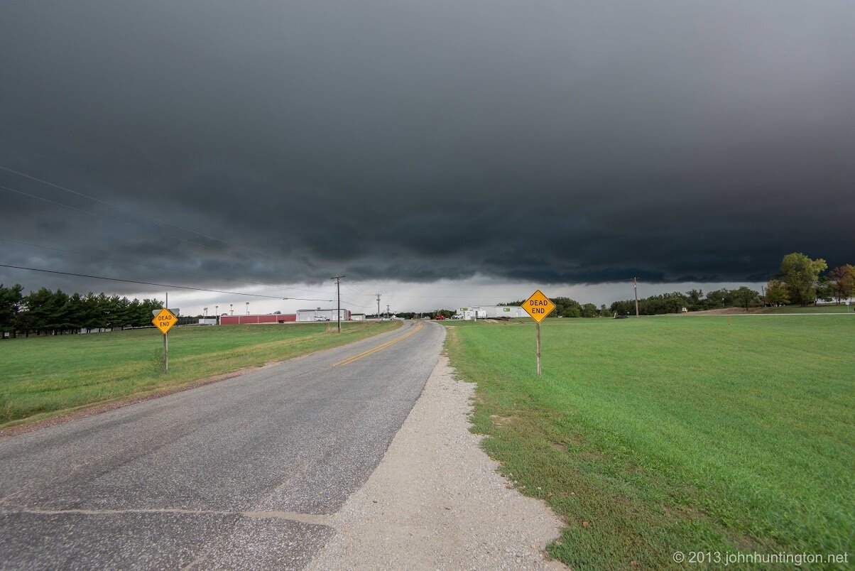
From near Mineola, another severe storm to the south that got a tornado warning after dark:
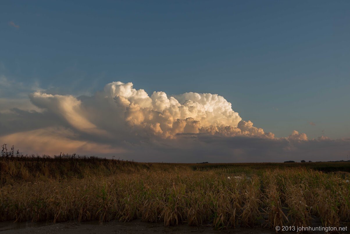
The original storm to the north
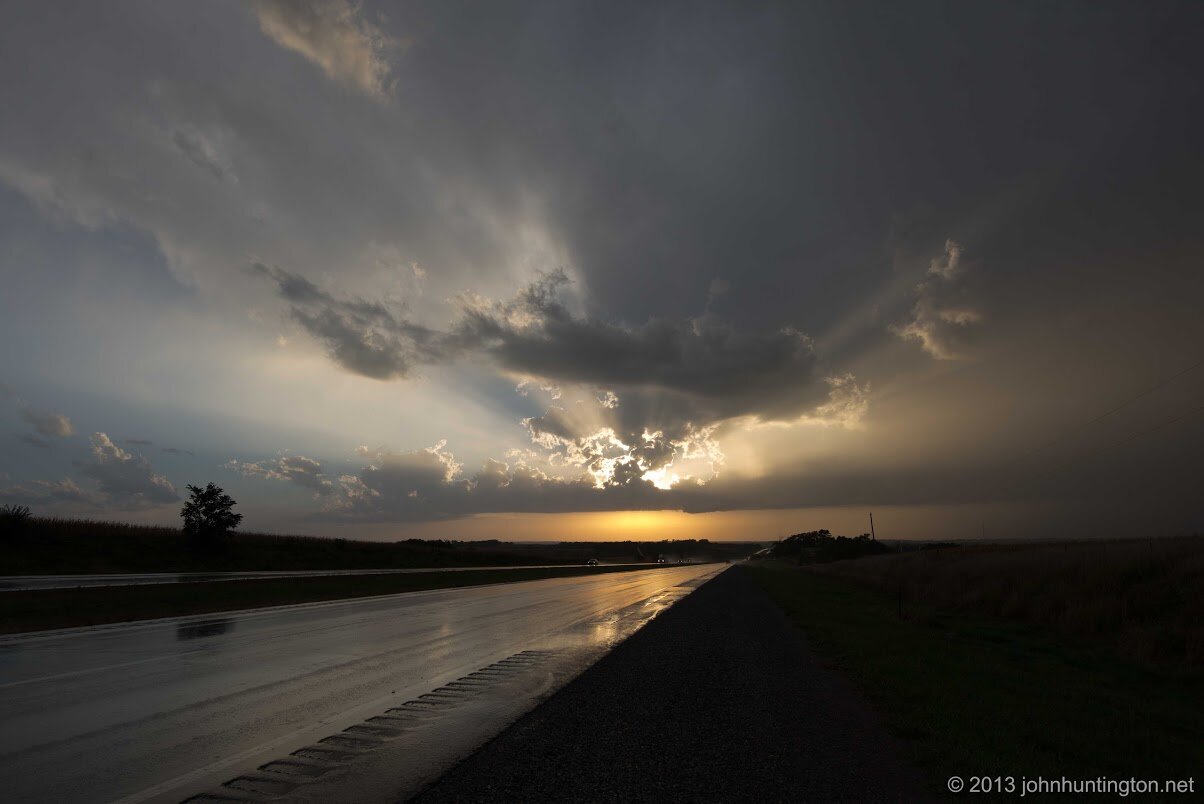
The southern storm again:


The southern storm, now over Red Oak with a tornado warning:

The blue target is me, I was stuck to the north of this storm but I figured I'd ride it out there and see what the west side looked like:


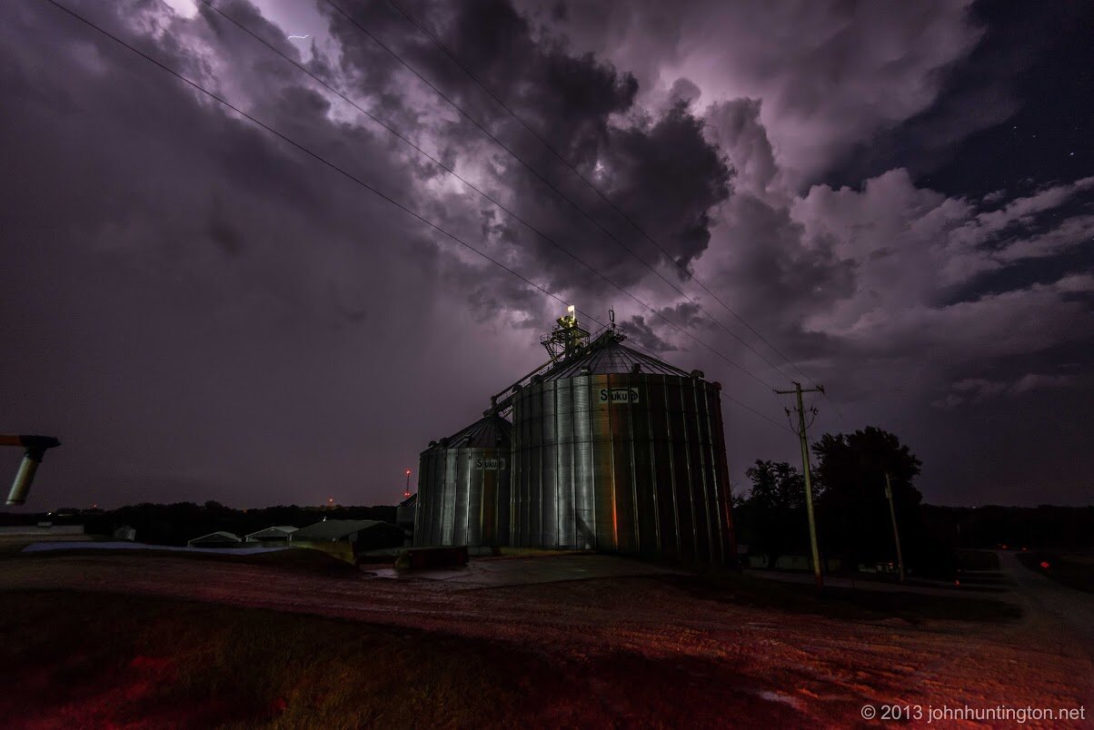
These silos are just northwest of Lewis:

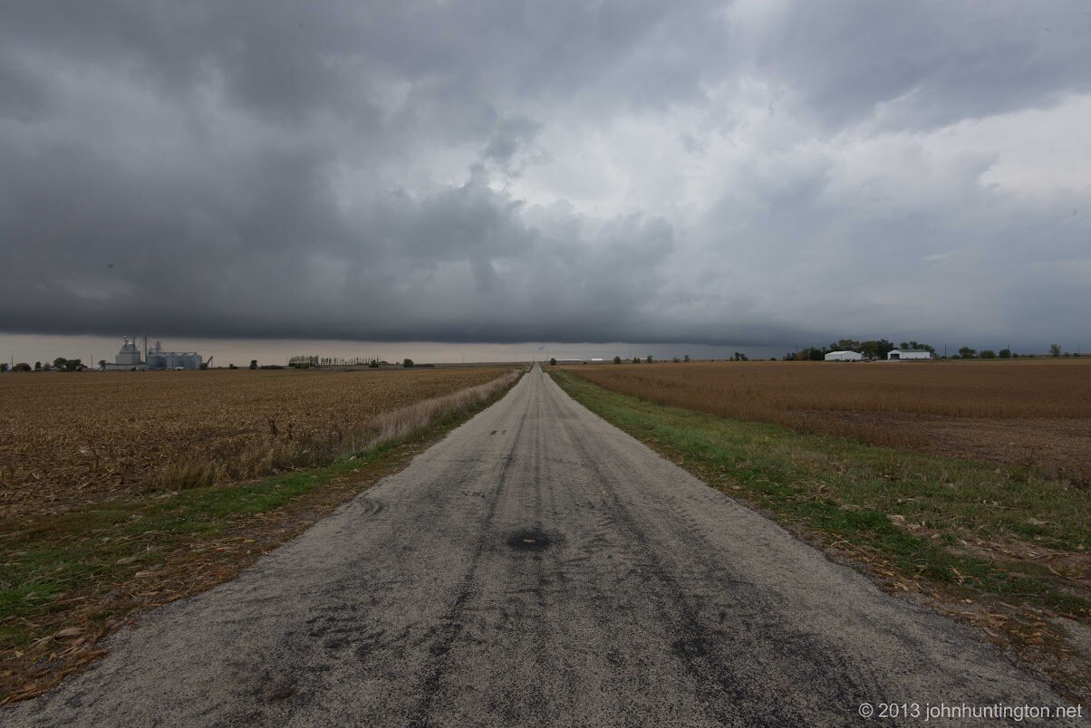
I stayed back in Des Moines for the night, and then yesterday chased severe storm conditions that jumped out way to my east. So I stopped and got a few photos near Chatsworth, Illinois in front of an approaching system that was severe off to the northeast farther than I could go (story of this trip):


More photos here and here. OK, now onto the storm chase geekery...
Thursday night my flight ran late due to thunderstorms in Chicago (which I go to watch from the plane) and Hertz took forever, so I only made it to Peru, Illinois that night. I had wanted to get further west but my cold was really slowing me down, but Peru that seemed like a reasonable reach to get out to Iowa in time for the big weather forecast for Friday afternoon, given the Moderate Risk already issued by the SPC. When I got up Friday morning, the models for this complex system had extended the severe threat west into Nebraska. Since this system was going to impact the area from west to east, I started heading as far west as I could get on I-80, having to pass through a first round of heavy rain, delaying me yet again. By the time I stopped for lunch the moderate risk area had pushed south and west again. So I figured I'd keep heading west and a little south of I-80 and try to get in front of the storms, which a quick look at the HRRR (simulated forecast radar) showed storms generating in front of the cold front in the south and travelling north.
Back on I-80 I saw the Adel storm from the highway, and I saw some lowering in it. I went to check it out and then it got a severe warning. With my cold-induced brain fog and a bit of a hook on this storm, I probably stayed on this storm a little too long, and then started west again. The SPC boys then issued a tornado watch well into Nebraska, and I thought about just blasting on straight into Nebraska (in hindsight this would have been the better choice) but with 250 miles of driving in already that day, all the while hacking and coughing (I went through two bags of cough drops on the trip), I didn't think I could safely make another 150 miles just to get to the start of a chase of indeterminate length.
I drove a bit further west and then tornado-warned storms started to fire in northeast Nebraska (and eventually produce very violent wedge tornadoes), but having chased up in that region before (here's my writeup of a previous chase bust) , I knew there were limited opportunities to cross the river, and I figured by the time I got to these storms they would fizzle out (I was also wrong about that). But around that time I saw a boundary on the radar along the storm line in Nebraska to the south of the tornado-warned storms, and I figured this would eventually kick up something in south west Iowa, so I headed down that way. I watched the cell above come across from Nebraska and followed it until sunset. Around this time the storm to my south got a tornado warning, but by that time it was well after dark so I hung around and shot the lightning photos above. So in the end, I missed all the tornadoes, but I felt a little better because I could see on Spotter Network and from several obvious chase vehicles in the area (I chase very low key, others have weather instruments and graphic wraps on their vehicles) that I wasn't the only one who made that same call and missed the action up north.
I headed back to Des Moines and crashed for the night. The next morning there was a slight risk out for Illinois, so, since I needed to go that way anyway to get back to the airport, I figured I'd get on whatever came along and maybe get some more lightning photos. But in the same way the severe threat moved out to my west as I was driving west, now the severe threat moved east faster than I could drive. I started out in the morning behind the cold front, crossed through it, but then storms fired out north and south. Everything died in my area by sunset, so I just headed to the hotel to try and get some sleep before my way-too-early flight this morning. One consolation: When it looked like I was going to end up way out west I changed my flight from Saturday night to early today, and I'm glad I did because a large severe-warned storm went right over Chicago Saturday night and delayed my original flight for about three hours couple hours.
So while in the end, I drove about 1,300 miles (630 just on Friday, the chase day) and didn't get to see much in the way of severe storms, that's something that can happen on these kind of chases (I once sat with hundreds of chasers in Nebraska in the center of a tornado watch under sunny skies all day, but the cap never broke so nothing happened until a big line developed after midnight.). As good as scientists are at forecasting the weather, these kind of complex systems are difficult to forecast. And my objective is to get photos of nature's beauty and menace, and in the end all the videos I've seen of people who got on the storms up north show big, ugly dangerous wedges on a hazy day. In the end, in this possibly record low tornado year, I think I already got on the most photogenic storm of the year in Rozel *(my photos here)
My thoughts are with those in Nebraska and Iowa who were injured or who lost property (as of this writing there are fortunately no reports of fatalities) and at least one chaser I know stopped and helped out when they saw significant damage in Nebraska.